Marine Ecology Digest October 2026
October’s digest follows coral reefs after mass bleaching, seagrass returning to anchor scars in Dorset, new mackerel catch advice and the rules needed to protect habitats on the high seas.
At Studland Bay in Dorset, patches of bare seabed have been getting smaller. In October, the Marine Management Organisation reported that anchor scars in the area where the first trial eco-moorings were installed had shrunk by an average of 93.6 per cent between 2021 and 2025. Three days after that announcement, the International Union for Conservation of Nature (IUCN) published its first global assessment of shallow-water coral reef ecosystems. It classified 96 per cent of the ecosystems it assessed as Critically Endangered when looking ahead to 2075. 5, 2
Two percentages. Two very different observations. One describes the change in the size of scars in part of a Dorset seagrass bed over four years. The other classifies the risk that reef ecosystems will lose their defining features over roughly half a century. Between those scales sit two other questions from this autumn. How should fishing nations respond when the scientific catch advice for a shared stock changes sharply? And how will the High Seas Treaty turn a proposal to protect a patch of ocean into rules that can be applied at sea?
What survived the bleaching?
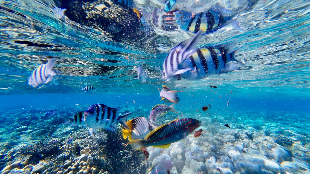
Coral can bleach and live. When seawater gets too warm for too long, reef-building corals can lose the symbiotic algae that live in their tissues and provide much of their food. The white skeleton then shows through the translucent tissue. If temperatures fall soon enough, a colony may regain its algae and survive. Prolonged or severe heat raises the risk of death, and a colony that pulls through can still face the demands of regrowing damaged tissue and reproducing before the next hot spell. 4
From January 2023 to September 2025, about 84.4 per cent of the world’s coral reef area experienced bleaching-level heat stress, according to NOAA Coral Reef Watch. Mass bleaching was documented in at least 83 countries and territories. Keep those observations separate when you read a global heat map. The first tracks exposure across reef area, using satellite-based estimates of accumulated heat stress. The second records where bleaching was documented. To find out how many colonies died at a particular reef, which species survived and whether young corals are settling there, researchers need observations in the water. 4
That distinction matters because a reef has a shape. A living branching coral offers narrow spaces where a small fish can retreat. When the colony dies, its skeleton can still provide shelter for a while. As dead branches break and the structure erodes, those spaces disappear. A survey of living coral cover and a survey of the reef’s physical complexity can therefore tell different stories about the same site. Even if living cover increases again, the kinds of corals that return will help determine what shelter the reef provides. 3
On 15 October, the IUCN reported the findings of a global reassessment of 892 reef-building coral species. Of the 774 species for which there was sufficient information to assign a threat category, 340, or 44 per cent, were classified as Vulnerable, Endangered or Critically Endangered. For another 118 species, the evidence was too sparse to assign a threat category. The reassessment also predates the 2023–2025 global bleaching event. Its figures describe extinction risk using the evidence available for that assessment period, and the authors caution that the proportion now threatened may be higher. 1
A week later came the assessment of whole reef ecosystems. Here, the question is whether a reef system can retain the combination of organisms, physical structure and ecological processes that define it. An individual coral species can persist in one place while a reef ecosystem elsewhere loses enough of those features to collapse. The IUCN identifies the western Galápagos Islands reef ecosystem as already collapsed. Its finding that 96 per cent of assessed shallow-water reef ecosystems qualify as Critically Endangered in the outlook to 2075 describes a level of risk. The trajectory will depend in part on how much warming occurs and how often reefs face severe heat. 2, 3
Local pressures still shape what happens between hot spells. Where fishing reduces the abundance of grazing fish, algae can take up space that young corals might otherwise occupy. After a heatwave, then, a useful field survey looks beyond the proportion of living coral on the day of the dive. It asks which colonies survived, whether juveniles are appearing and what’s growing on the exposed reef surface. Repeat the survey, and you can begin to tell whether the next generation is getting established or whether a brief improvement in coral cover is likely to stall. 2
Studland Bay measures recovery one scar at a time
An anchor can cut through a meadow. As the boat swings, its chain can sweep across the seabed, disturbing the sediment and damaging the shoots and buried stems that allow seagrass to spread. Repeat that disturbance in the same patch and the gap can stay open. At Studland Bay, the Marine Management Organisation introduced a voluntary no-anchor zone in 2021 and worked with the Studland Bay Marine Partnership on alternative moorings. The trial gave visiting boats another way to stop in the bay while reducing the physical pressure on the plants below. 5, 6
By 2025, in the area around the first trial installations, bare patches had shrunk by that average of 93.6 per cent. The Marine Management Organisation reported recovery of around 57 square metres a year in the monitored area. The place and the starting point give the figures their meaning. If a square metre of bare seabed closes up, that’s a measurable gain within the scar. To work out how much the whole meadow has changed, you’d also need to map what’s happening at its outer edges and in areas away from the trial. 5
Why count bare patches at all? Because the question at Studland was specific. Could damaged areas close once boats had an alternative to dropping anchors there? Measuring the gaps follows the injury itself. Counting how many moorings were installed would tell you how much equipment went in. Measuring the scars tells you what happened to the habitat near the installations over the following years. Those two records, read together, are more informative than either one on its own. 5
At another bay, the same equipment could solve a smaller share of the problem. Seagrass needs light. Where nutrient enrichment encourages algal growth, or suspended sediment clouds the water, a meadow can struggle even if boats cause little disturbance. And if a bare area is far from surviving plants, there may be fewer shoots nearby to extend into the gap. For a site considering the Studland approach, the useful comparison starts underwater. What caused the bare patches? How close is living seagrass? How much light reaches the bed during the growing season? The answers determine how much recovery you can reasonably expect from reducing anchor damage alone. 6
Mackerel advice rises as nations weigh their shares
The figure going into autumn negotiations was 352,938 tonnes. On 30 September, the International Council for the Exploration of the Sea (ICES) advised that catches of North-East Atlantic mackerel in 2027 should stay at or below that level under its maximum sustainable yield approach. The comparable scientific advice for 2026 was 174,357 tonnes. The new ceiling is a little more than twice the old one. Both figures describe advised catches for a year, calculated using an assessment of the stock and a rule for translating that assessment into fishing pressure. 8, 7
What does that rule do? In the published 2027 scenario, ICES scales the target fishing mortality down because estimated spawning-stock biomass is below the reference level at which the rule starts to reduce fishing pressure. Spawning-stock biomass is the estimated weight of the mature fish capable of contributing to reproduction. It’s a different quantity from the tonnage a fleet can bring ashore in a year. Read the catch figure alongside the biomass estimate and the fishing mortality rate, and you can see how the assessment treats the stock’s ability to replenish itself. 8
Then comes the allocation. In their arrangement for 2026, the UK, Norway, the Faroe Islands and Iceland agreed to use 299,010 tonnes as the total allowable catch on which to base their respective quotas. That figure exceeded the ICES advice for the year. To follow the fishery, keep a separate record of the scientific advice, the tonnage governments use when setting their quotas and the catch eventually reported. In a shared fishery, the comparison needs to include all the fleets taking fish from the stock. A quota announced by one government only tells you what that government has allocated. 9, 7
The four-party record also calls for an annual update on the distribution of mackerel in the North-East Atlantic. There’s a practical reason to keep that series current. If fish spend more of the feeding season in one jurisdiction’s waters, the fleets working there can encounter a different share of the stock. A change in where fish are available can affect fishing opportunities even when the number of fish across the assessment area follows a different trend. Surveys of distribution and assessments of stock size help answer those separate questions, and both matter when governments discuss who gets to catch what. 9, 8
What a high-seas protected area would have to specify
Since 17 January 2026, the High Seas Treaty has been in force. Formally known as the agreement on marine biodiversity in areas beyond national jurisdiction, or BBNJ Agreement, it sets out a process for establishing area-based management measures, including marine protected areas. It also covers environmental impact assessments, marine genetic resources and the sharing of benefits, and capacity-building and the transfer of marine technology. Its geographical scope includes the high seas and the international seabed area, where the institutions responsible for different activities can vary. 10
Imagine a proposed protected area around a seamount. To draw a useful boundary, you’d first need to specify what you’re trying to protect. If the objective is to conserve slow-growing animals attached to the seabed, the proposal needs evidence about where those animals occur and which activities could physically damage them. If the objective includes animals that gather in the water above the summit for only part of the year, the proposal may need seasonal observations too. The same coordinates can contain both habitats. The evidence needed to describe them, and the measures likely to help them, can differ. 10
There’s an institutional question as well. The treaty sets out how parties can propose measures and consult on them, with provisions for working alongside existing bodies that have relevant responsibilities. A proposal needs to account for who already manages activities in the area and how the proposed measures would fit with those arrangements. For someone reading a future designation, the details worth looking for are the activities covered, the timing and boundaries of any restrictions, and who will monitor compliance. The ecological monitoring has a separate job. It needs to show whether the habitat or species the measure was designed to protect is responding over time. 10
At Studland, a later survey can return to the same patch of seabed and measure what’s left of an anchor scar. On a tropical reef, divers can revisit a marked plot and look for young corals among the survivors of a heatwave. For mackerel, the next comparison will come when catch records can be put alongside the advice for the fishing year. Each of those observations answers a question that was defined before the result came in. A high-seas protection proposal has the chance to do the same from the outset, while the boundaries are still being drawn and there’s time to decide what evidence a future review will need.
References
- IUCN coral species reassessment
- IUCN global reef assessment
- IUCN Red List of Coral Reef Ecosystems
- NOAA Coral Reef Watch global bleaching report
- Marine Management Organisation Studland Bay monitoring results
- Marine Management Organisation seagrass guidance
- ICES mackerel catch advice for 2026
- ICES mackerel catch advice for 2027
- Scottish Government four-party mackerel arrangement
- United Nations BBNJ Agreement